

blah blah blah
Mt. Sunapee South Peak
Length: 3.0 miles out-and-backDifficulty (click for info): Easy
Elevation Gain: 1180 feet
Rating (click for info): 4/10
Elevation: 2608' (summit), 2330' (north knob ascended to in this hike)
Prominence: 60' (summit), 20' (north knob)
Driving Directions:
Trailhead is on Lake View Avenue in Newbury, NH. To get there, take Newbury Heights Road off Rt. 103, 0.2 miles north of Rt. 103A in the center of Newbury. In less than 0.1 miles, turn right onto Lake View Avenue. The trail is just up this road, on the right side, marked by a sign. Park on the side of the road.
Trail Map
About the Hike:
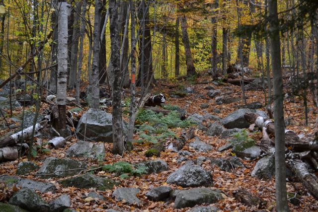
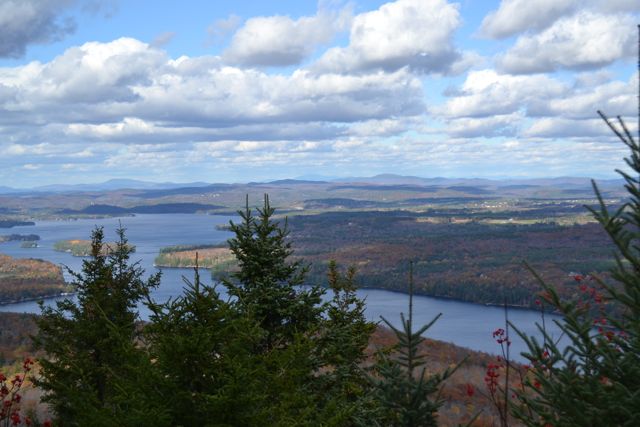
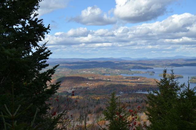
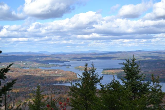
Mt. Sunapee, home to the Mount Sunapee Ski Area, also has a network of hiking trails on the side not occupied by ski trails. The most popular destination is White Ledges (see Mt. Sunapee), but a lesser known place with a nice view is the Newbury Trail outlook near Sunapee's South Peak, which has a good view of Lake Sunapee. Along the way, you can stop at Eagle's Nest, a smaller overlook which provides a closer view of the lake. The Newbury Trail to Eagle's Nest is easy, winding through the forest and climbing at a gradual rate. In 0.4 miles, look for a small cairn on the right. This marks a short spur which leads 0.2 miles out to this rocky viewpoint. Although somewhat restricted by trees, it provides a close-up view of Lake Sunapee, Newbury Harbor, and the houses on the hillside behind the lake.
Continuing on, the trail ascends gradually, then swings to the right and heads across the hillside, with rocky cliffs visible through the woods to the left. It reaches a junction with Rim Trail 0.7 miles from the Eagle's Nest spur. Turn left to stay on Newbury Trail and ascend a steep, rocky pitch, reaching the outlook to Lake Sunapee in 0.2 miles.
Printable directions page